


| Walks Programme 2025 |
|
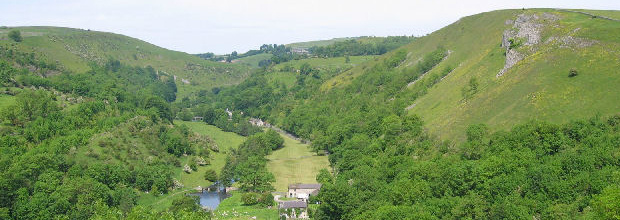
All walks depart from the meeting point at 10.00am, PLEASE ARRIVE IN GOOD TIME to ensure a prompt start. [ Download pdf file for printing. ] |
| Date |
Route / Distance /
Difficulty |
Meeting Point |
|
16th Mar 2025 |
Dunham Massey ñ Lymm 15km (9.5m), easy |
Meet at 9.45 for a 10 am start. Henshall Lane ñ free car park [Start: SJ 728 886] -> Google Map Post Code: WA14 5SH Latitude: 53.393551, Longitude: W2.410716 ( 53 23' 36.78"N 2 24' 38.57"W ) What3words: https://w3w.co/plugs.reduction.koala |
|
13th Apr 2025 |
Hayfield - Buxworth 14.5km (9.5m), moderate |
Meet at 9.45 for a 10 am start. Station Rd - Pay & display [Start: SK 036 869] -> Google Map Post Code: SK22 2ES Latitude: N53.379047, Longitude: W1.946804 ( 53 22' 44.56"N 1 56' 48.49"W ) What3words: https://w3w.co/forklift.ghosts.blazers |
|
11th May 2025 |
Burbage Rocks - Hathersage 13km (8m), strenuous |
Meet at 9.45 for a 10 am start. Upper Burbage Bridge Car Park [Start: SK 260 830] -> Google Map Latitude: N53.343386, Longitude: W1.610366 ( 53 20' 36.18"N, 1 36' 37.31"W ) What3words: https://w3w.co/dining.lists.knots |
|
1st Jun 2025 |
Ogden Reservoirs 13km (8m) |
Meet at 9.45 for a 10 am start. Car park by Ogden Res (free) [Start: SD 953 122] -> Google Map Latitude: N53.60618, Longitude: W2.073126 ( 53 36' 22.24"N, 2 4' 23.25"W ) What3words: https://w3w.co/emeralds.boards.collects |
| 22nd Jun 2025 |
Hulme End ñ Butterton 13.5km (8.5m) |
Meet at 9.45 for a 10 am start. Pay and display, Manifold Trail visitor centre, B5054. [Start: SK 102 592] -> Google Map Latitude: N53.129868, Longitude: W1.849012 ( 53 7' 47.52"N, 1 50' 56.44"W ) What3words: https://w3w.co/mice.debut.tracking |
|
20th Jul 2025 |
Monsal Head ñ Bakewell 14.5km (9m) |
Meet at 9.45 for a 10 am start. Monsal Head ñ pay & display or park on Butts Road [Start: SK 185 716] -> Google Map Latitude: N53.240674, Longitude: W1.724050 ( 53 14' 26.42"N, 1 43' 26.58"W ) What3words: https://w3w.co/smallest.risen.meanwhile |
|
10th Aug 2025 |
Wildboarclough - Wincle 12km (7.5m) |
Meet at 9.45 for a 10 am start. Layby by Clough Brook south of Crag Inn. [Start: SJ 981 682] -> Google Map Latitude: N53.2105425, Longitude: W2.0305687 ( 53 12' 37.95"N, 2 1' 50.04"W) What3words: https://w3w.co/thrashed.using.flexed |
|
31st Aug 2025 |
Tandle Hill Circular 15.5km (9.5m), easy |
Meet at 9.45 for a 10 am start. Free car park. [Start: SD 907 087] -> Google Map Post Code: OL2 5UY Latitude: N53.575117, Longitude: W2.141986 ( 53 34' 30.42"N 2 8' 31.14"W ) What3words: https://w3w.co/tones.spoil.united |
|
21st Sep 2025 |
Hope ñ Little Hucklow 15km (9.5m) |
Meet at 9.45 for a 10 am start. Pay and display in Hope or on the road opposite the car park or near Netherhall Bridge. [Start: SK 171 835] -> Google Map Latitude: N53.34825, Longitude: W1.74464 ( 53 20' 53.7"N -1 44' 40.7"W ) What3words: https://w3w.co/imprinted.closed.serenade |
|
19th Oct 2025 |
Widdop - Swinden 15km (9.5m), moderate |
Meet at 9.45 for a 10 am start. Widdop Reservoir Car Park - free parking Ridehalgh Lane [Start: SD 938 328] -> Google Map Post Code: HX7 7AU Latitude: N53.791370, Longitude: W2.096121 ( 53 47' 28.93"N, 2 5' 46.03"W ) What3words: https://w3w.co/tokens.boldest.obliging |
|
9th Nov 2025 |
Youlgreave - Over Haddon 14km (8.5m) |
Meet at 9.45 for a 10 am start. Youlgreave ñ car park at end of village(honesty box) [Start: SK 20501 64052] -> Google Map Latitude: N53.173187, Longitude: W1.694754 ( 53 10' 23.47"N, 1 41' 41.11"W ) What3words: https://w3w.co/vowed.shady.scales |
|
Saturday 6th Dec 2025 |
Disley - Marple 12km (7.5m) |
Meet at 9.45 for a 10 am start. Disley station - pay and display. [Start: SJ 973 846] -> Google Map Post Code: SK12 2AE Latitude: N53.358427, Longitude: W2.041556 ( 53 21' 30.33"N, 2 2' 29.6"W ) What3words: https://w3w.co/cherry.logbook.extreme |